County Birding Maps of the Upper Texas Coast (Archival Index)
Compiled originally with the Houston Outdoor Nature Club Ornithology Group, the Upper Texas Coast County Birding Maps index covers public wildlife access across Brazoria, Chambers, Fort Bend, Galveston, Harris, and Jefferson counties, linking each county directly to detailed sanctuary driving directions and seasonal birding checklists.
Six-County Sanctuary & Habitat Directory
Use the county index and historical Outdoor Nature Club — Ornithology Group county maps below to locate sanctuaries, refuges, and driving routes across the six Upper Texas Coast counties:
- Brazoria County: Brazoria NWR · San Bernard NWR · Bryan Beach & Freeport · Christmas Bay · Freeport Pelagic Departure
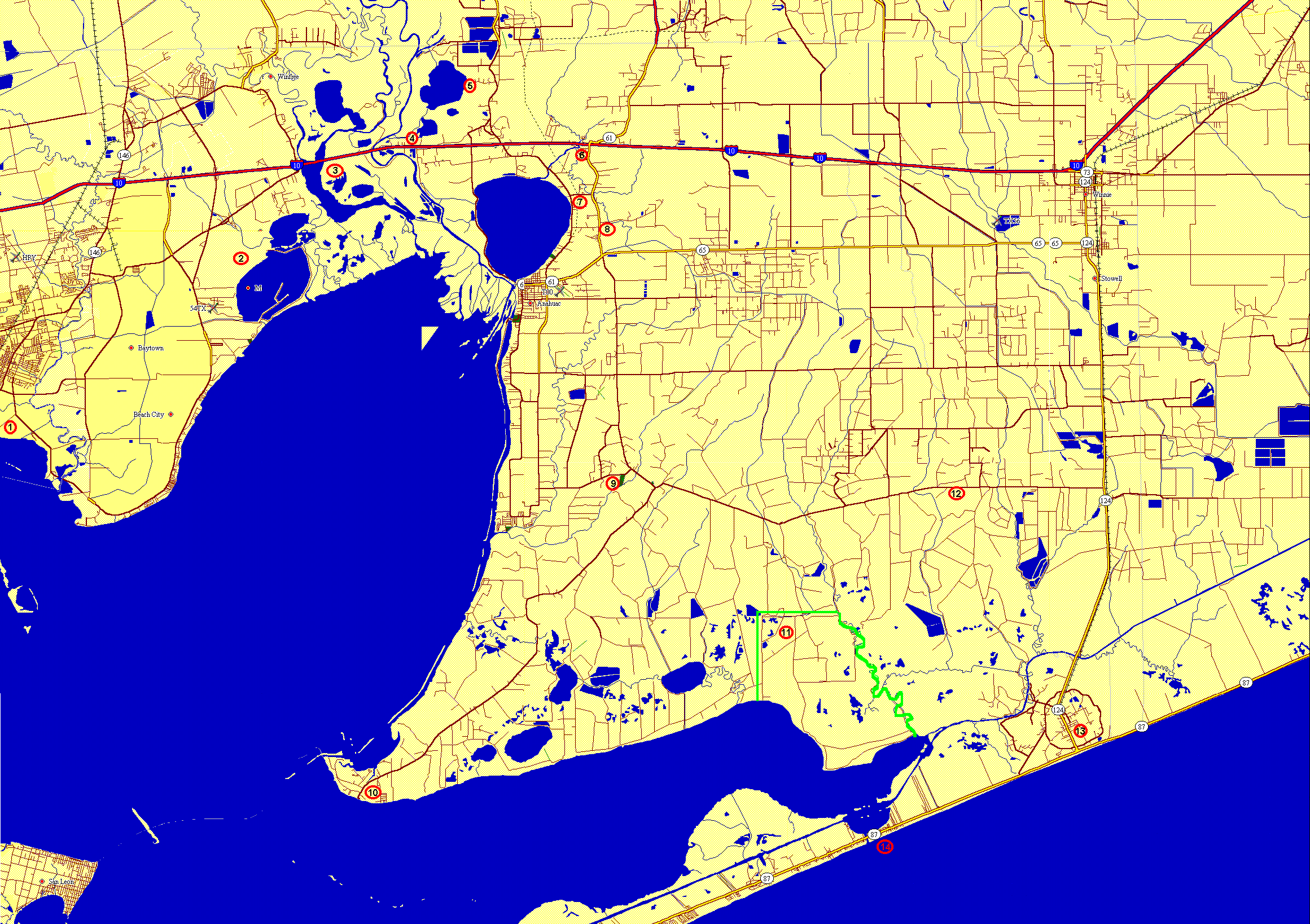
- Chambers County: Anahuac NWR (Seasonal Checklist) · City of Anahuac Nature Trail · Candy Abshier WMA at Smith Point · White Memorial Park
- Fort Bend County: Brazos Bend State Park (Seasonal Checklist)
- Galveston County: High Island Sanctuaries (Seasonal Checklist) · Bolivar Flats · Rollover Pass · Big Reef Nature Park / East Beach · Galveston Island SP (Checklist) · San Luis Pass
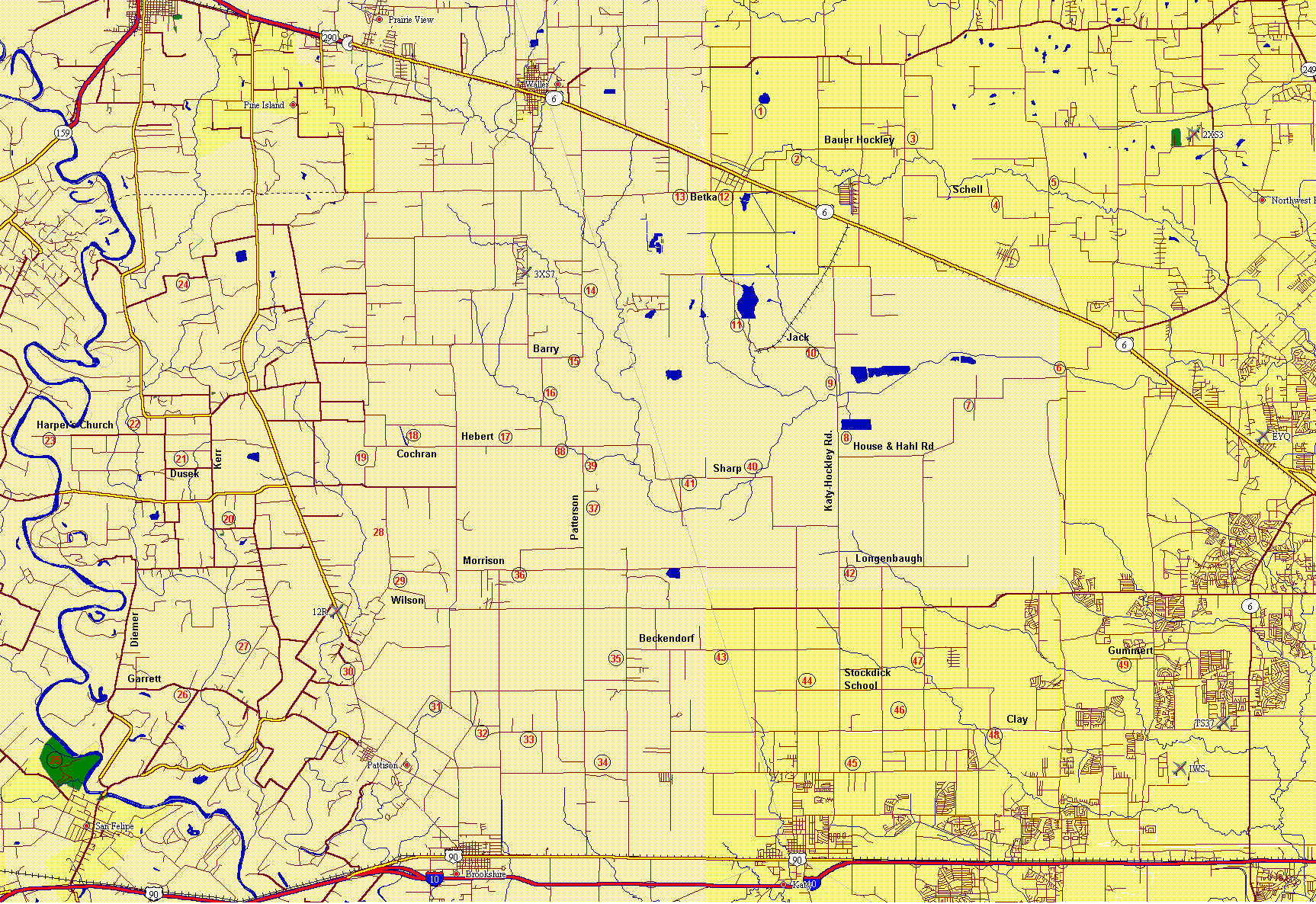
- Harris County: San Jacinto Battleground Marsh · Sheldon Lake State Park · W.G. Jones State Forest
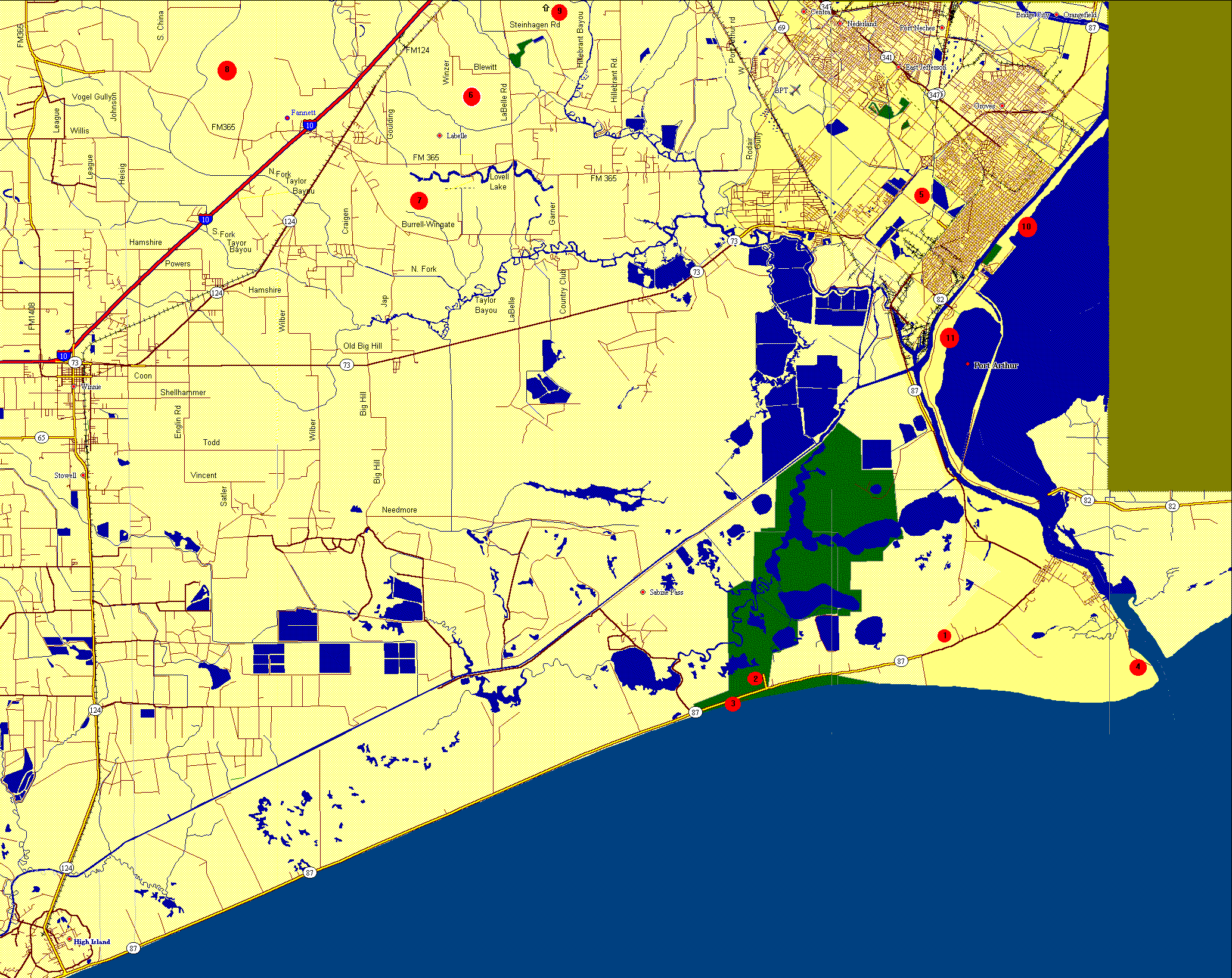
- Jefferson County: Sea Rim State Park · Sabine Woods & Texas Point NWR



County Birding Maps
These birding maps are based on maps compiled by the Outdoor Nature Club - Ornithology Group. Some of these maps are pretty huge so if you have a slow connection you might want to just view the text for that map.
Back to the Bird Index
These birding maps are based on maps compiled by the Outdoor Nature Club - Ornithology Group. Some of these maps are pretty huge so if you have a slow connection you might want to just view the text for that map.
- Brazoria County - text only
- Chambers County - text only
- Fort Bend County - text only
- Galveston County - text only
- West Harris and Waller County - text only
- Jefferson County - text only
Back to the Bird Index